Day 8, April 11: Villapedre to Navia

Walking on a little road

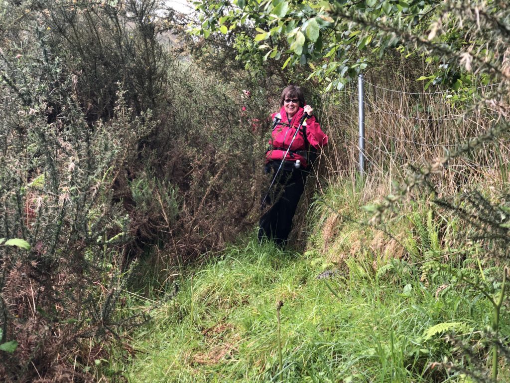
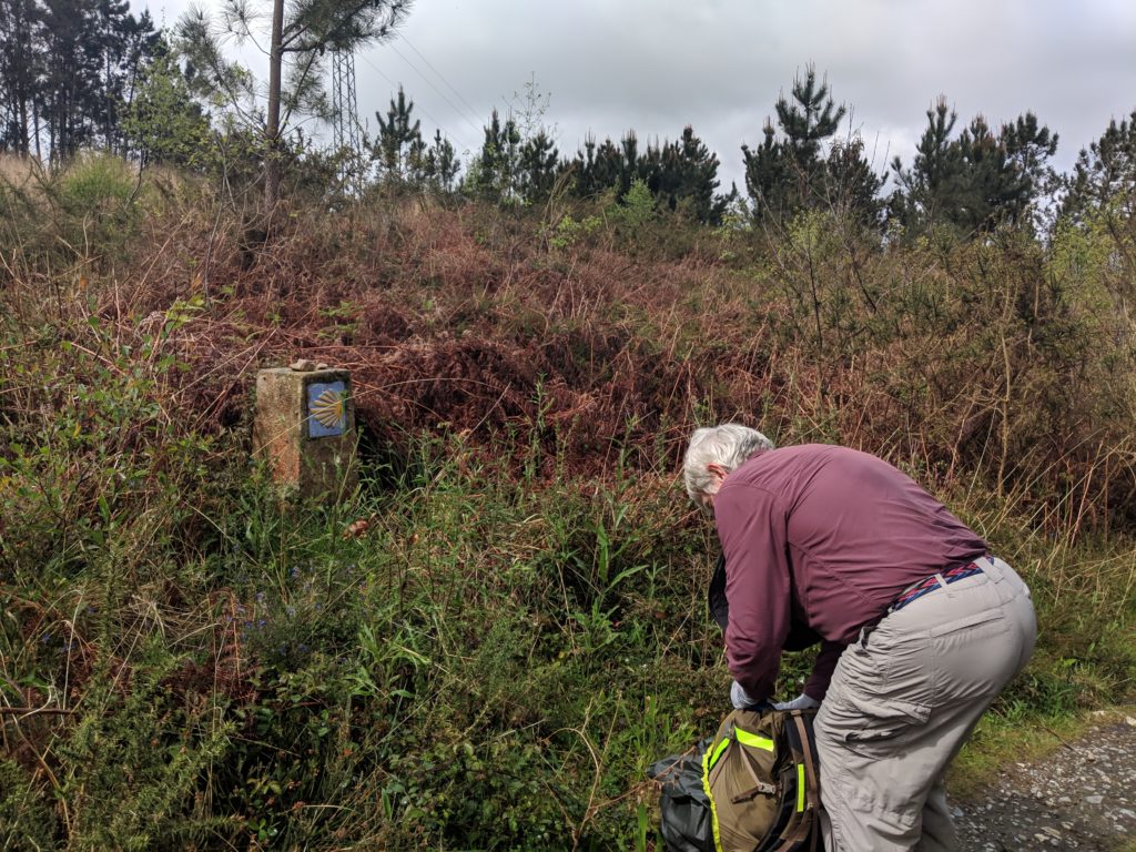
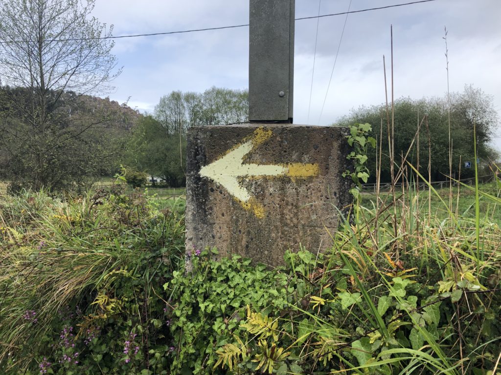
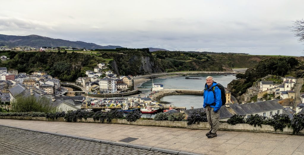
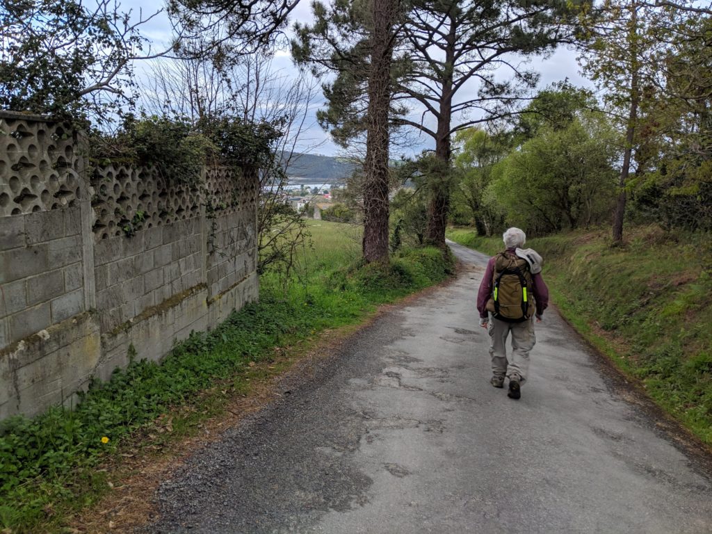
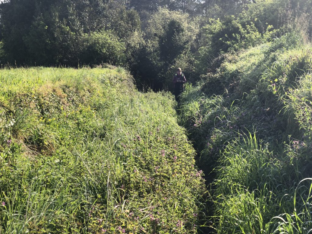
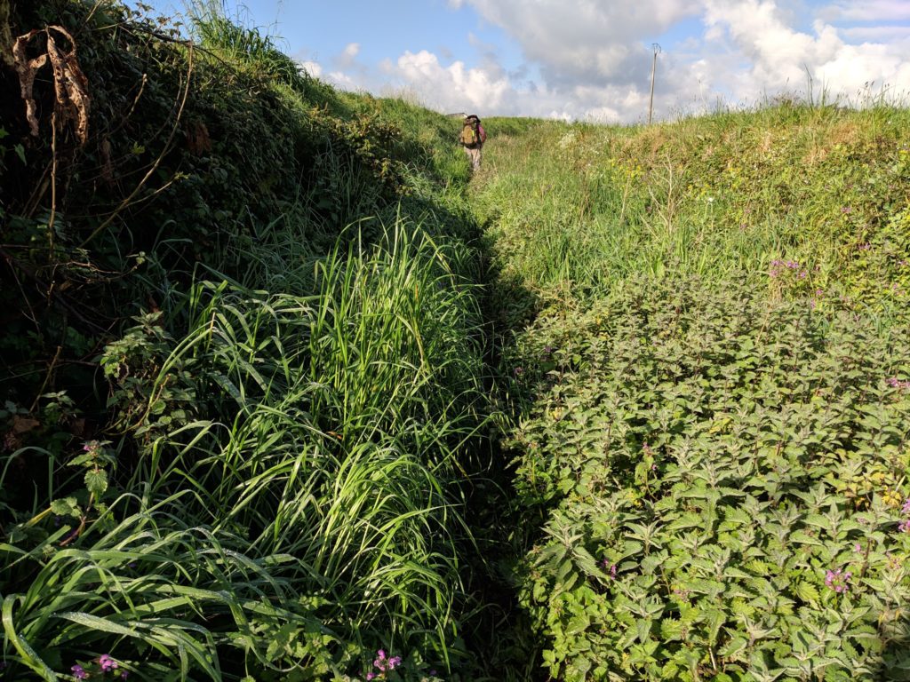
Post by Wynette: We walked 7.2 miles today. That includes 2 km round-trip to/from the laundry after we got to Navia. And we didn’t get lost or anything, so it was an easy day. Mostly on quiet roads like above photo. A little was on muddy trails through a pretty bosque and about 100 yards was through a field on an 8 inch wide trail pushing through what we are pretty sure were stinging nettles. (Photo below.) Our legs were stinging a bit at the end, even though we had on long pants. Still feel a little itchy. I can’t imagine going through there in shorts. Surely they mow a larger path through this section in the busy, warmer season. As Charlie said, it was very nettlesome.

Nettie in the nettles

Charlie in the nettles

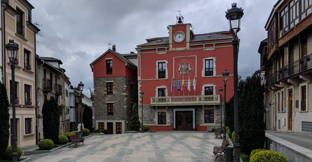
Navia is a little town of 10,000. Towns this size in this part of Spain are so vibrant and alive. Of course, they seem huge to us after the tiny villages we walk through. Below is the ayuntamiento, or city hall.

Ayuntamiento de Navia

We checked into our hotel then walked to restaurant for a delicious menu del día and then walked to the laundry which was in a large supermarket. The sign in photo below says While you do your shopping or have a coffee, do your washing.

Doing the laundry

Day 7, April 10: Luarca to Villapedre

About a third way through the tunnel

Post by Wynette: We walked 9 miles today. We spent an anxious 45 minutes on a tiny fraction of those miles. We sort of got lost. We have some GPS tracks that supposedly someone else has walked before and labeled as the Camino. We came to a fork where the Camino went right and our track went left. The track looked much more direct so we decided to follow the track.

The track took us over the large A8 freeway where the A8 went way below us through a long tunnel. This was a rugged dirt road we were on, but so far so good. Then the GPS track took us to a 50 yard long concrete tunnel that went under the A8, far below the A8. (We couldn’t even hear the A8 at this point.) It looked as though no one had gone this way for a long time, but we’d already come down a long downhill to get here and didn’t want to backtrack.

So we went into the dark tunnel. Even though we weren’t far from the A8, it seemed miles away and everything seemed remote and foresty. Of course, we figured there’d be a nice trail at the end of the tunnel. There was a walkway through the tunnel with a small stream flowing beside it. We couldn’t see but used our phone flashlight. We finally got to the other end. The walkway ended and the stream widened and we discovered there was no path at the end of the tunnel. Only a thicket of spiny gorse and thorny blackberries. At first it seemed impassable but man we didn’t want to backtrack at this point. We could tell from our Google map that there was a trail not far away. We managed to find a path of sorts through the thicket. We were wearing our rain coats and that helped.

Emerging from the thicket

After pushing through this for about 15 minutes we spotted a more open area down the hillside. Charlie headed for it and, because the hillside was uneven and he was top-heavy with his backpack, he fell down twice. There was so much vegetation it cushioned his falls. Luckily no injuries. In the more open area, we walked through viney ferns for a while and then spotted the trail. We headed for it and, to our surprise, first thing we saw was a Camino post! The Camino took us down a rocky creek bed but the Camino never looked so good. OK, we have had enough adventures for a while.

Back on the Camino

Pote Asturiano

Post by Wynette: Some variation of this stew is a first course choice on just about every menu del día we’ve had. I’m not sure how appetizing this photo makes it look, but it is delicious. The stew usually has fava beans, two or three types of sausages, greens, a hearty broth, and often potatoes. I’ve asked about the greens and they always say berza which Google translates to cabbage, but, of course, it’s not what we call cabbage. We think they might be collard greens. The Asturians are very proud of their food, as is every region in Spain (and probably the world). They often proudly describe a dish as típico, meaning it’s typical of the region.

GPX vs Yellow Arrows

All Caminos are marked with yellow arrows. Some are better marked than others but on the Camino Frances (the main one) you could easily walk the entire 800 kilometers without a guide or a map or a gps, just following the yellow arrows. They are friendly and reassuring. They always show up when you need them.

They also mean that you can walk without a care, thinking about things, without worrying about navigating, just follow the yellow arrows. I guess this is anti-mindful but, I think, in a good way. You get lost in the process which is part of what a Camino is all about.

GPX tracks do this in a way also but in a very techy way. Sometimes they seem to consume a lot of your attention and make you concentrate on the path rather than the journey. I guess it is how you treat it. I tend to look at my phone a lot and keep track of where I am.

When you are a double (and triple) checker like Wynette they are great since you know you are on the correct trail.

Day 6, April 9: Cueva to Luarca

About to descend into Luarca

Post by Wynette: Today was another easy day. We walked 6.5 miles, not too much up and down except for final steep decent into Luarca (photo above). Here is the track. Luarca is a pretty and vibrant town of about 10,000. We walked to our hotel, left our stuff, immediately went to the harbor area looking for a good seafood restaurant. (That walk around Luarca added another 2.5 miles to our day.) We had a seafood lunch that couldn’t be beat. The waiter (probably the restaurant owner) gave Charlie a lesson in how to drink sidra. This is a video of that. Might take a minute to load. But Charlie learned his lesson well. (Another video.) Charlie wanted me to explain that the sidra is a bit sour.

Scallops for lunch


GPX tracks and wikiloc

I thought I might explain the tracks I am sending. A “gpx” track (aka gps track) is a text file that is basically a list of GPS readings plus some identifying information (metadata). A gps reading is a time plus a location somewhere on the earth, that is, a latitude, longitude, and elevation. The track records a trip, aka route. A gpx tracker app on your phone will record a walk by taking a gps reading every, say, 10 meters (you can decide how often). When you finish, it packages them all up in a gpx track for you.

The wikiloc app is an app that will do this. When we start out I start the track and when we finish I end it, give it a name, and upload it. The wikiloc web site provides access to these tracks and shows them in a nice format on a map, provides altitude graphs, computes various statistics, etc.

Besides recording your trips in the wikiloc app you can also download a track that someone else has recorded and “follow” the track. We are doing that also and have found a track for each stage of our Camino. The app sends you a notification if you get off-track.

We have used gpx tracks for the last three Caminos but this is the first time we have used wikiloc. It is a nice app and ha a nice web site. It is used by a lot of people on the Camino.

In general wikiloc seems to have gotten quite popular with all hikers and walkers. It has tons of trails, you might say too many, it can be hard to navigate and find the one you want.

If you are interested in recording your walks you might give it a try. Just download the app on your phone. It is dead easy to use.

slideshows

I got confused. Here are some more slideshows. One or more may be duplicate. Added by Wynette: All these slideshows are created by Google Photos. We probably would pick different photos and music, but fun to see what Google chooses to include. Charlie has gotten into taking photos of Hórreos so they are a bit over-represented in the slideshows. But there are huge numbers of them here in Asturias. There are lots in Galicia, too, but there they are rectangular. Here they are square.

https://photos.app.goo.gl/T9W8fLQcbb9XkFrc8

https://photos.app.goo.gl/v6HtppjE8w5k4qmP8

https://photos.app.goo.gl/p82R55VmFTPPx7wu8